Are you ready to go to Switzerland?

Hi all,

     Vicky and I recently returned from a trip to Switzerland and Italy (October 2025). Who knew we would ever travel to such fabulous places. We spent nine of the days in Switzerland and had a really great time. Like many places we visit, I wish I had gone there sooner, but better late than never.

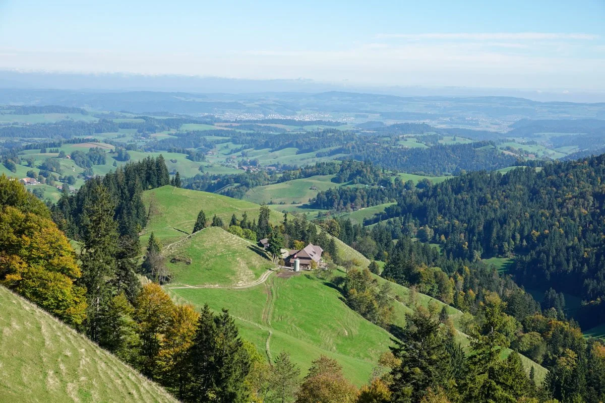
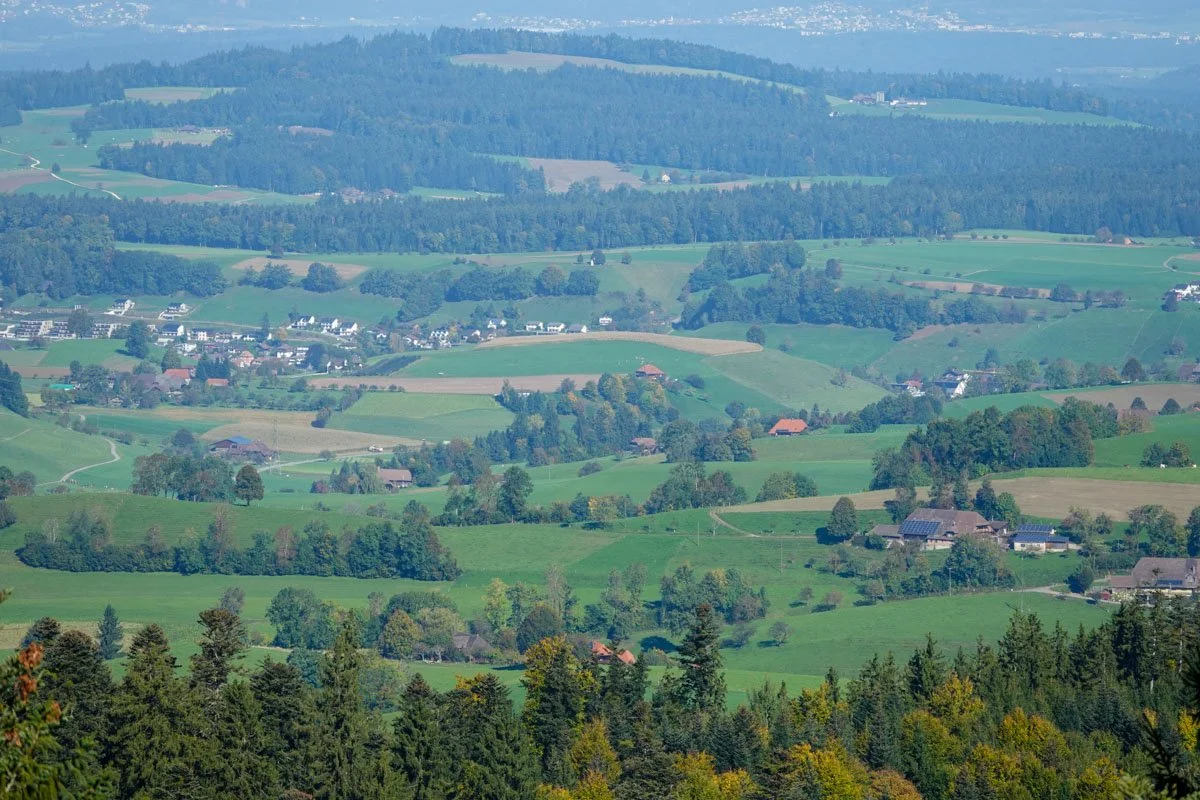
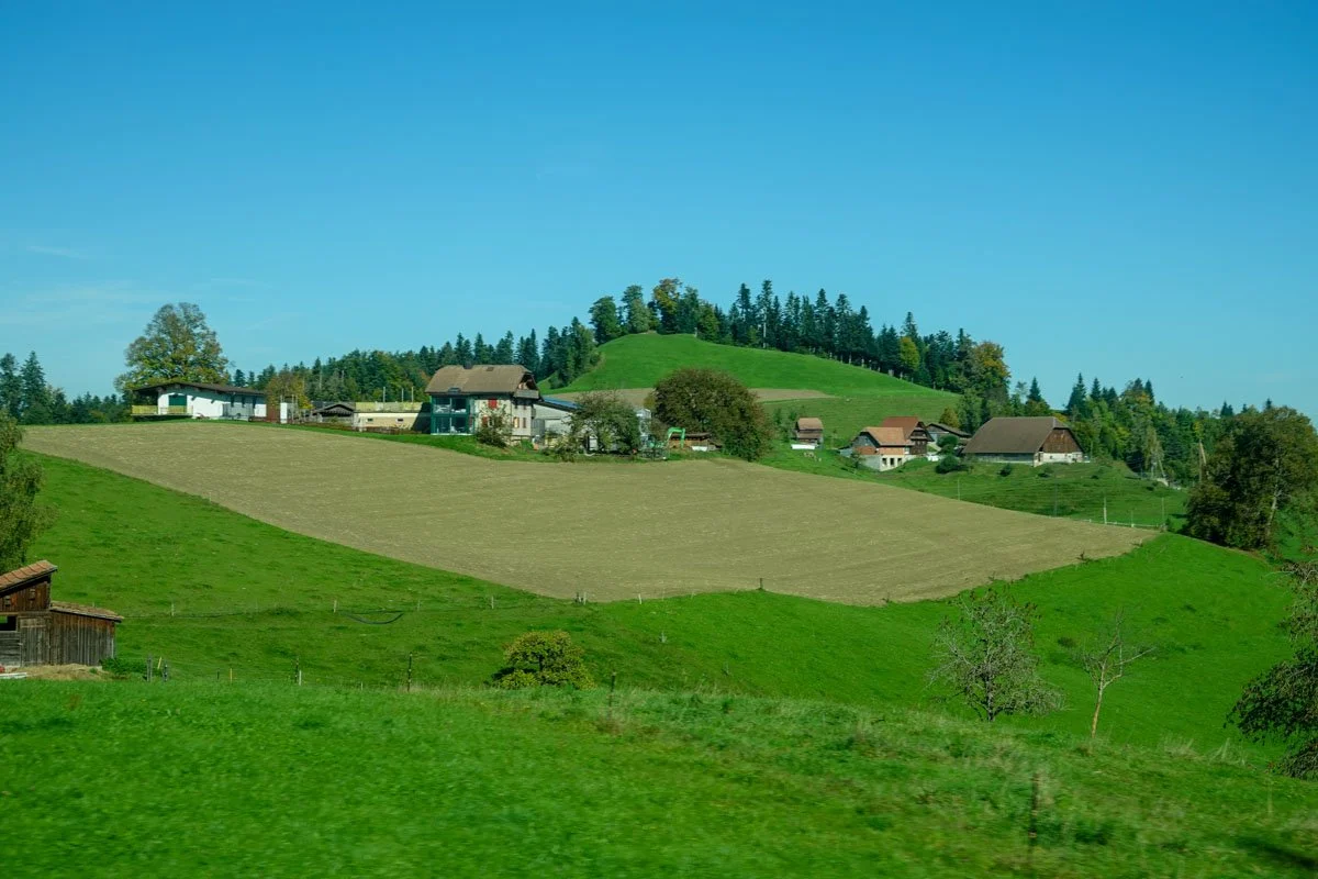
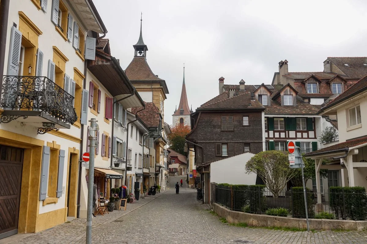
     We spent our time in Switzerland in the Swiss Alps and the Swiss Plateau. The Alps were never out of our sight, and we ventured high up several times. We didn't spend time in Zurich or Geneva so it was not the big cities tour, but we did stay in Lucerne and Bern.

     Our Swiss guide told us that to think of Switzerland, "just think of Maryland (for size) with 26 states and four languages." There are nine million people living in Switzerland, but we rarely found ourselves in much of a crowd. Their four languages are spoken in different parts of the country and are: German, French, Italian, and Romansh. For my part, English was widely understood.

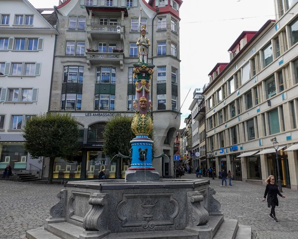
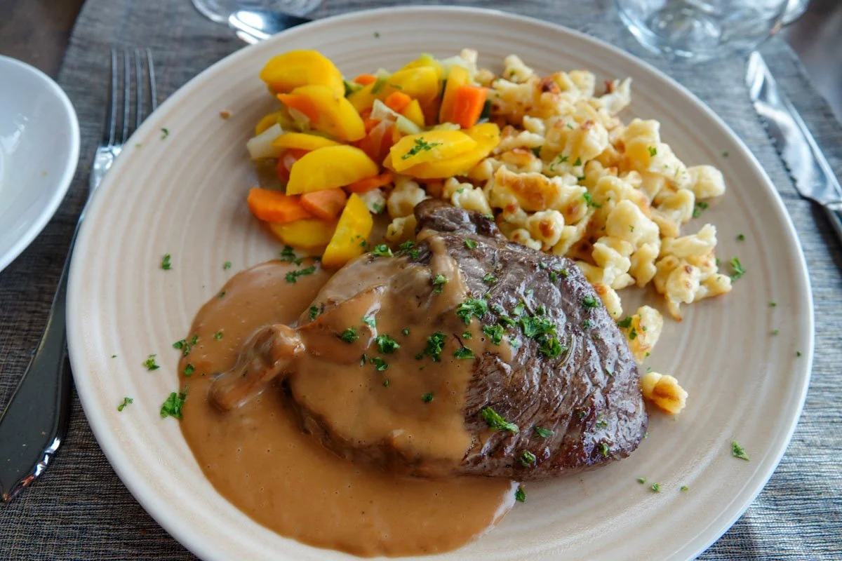
     Switzerland is a land of mountains, chocolate, lakes, tunnels, chocolate, glaciers, water fountains, history, chocolate, rivers, and much more, and did I mention the chocolate?

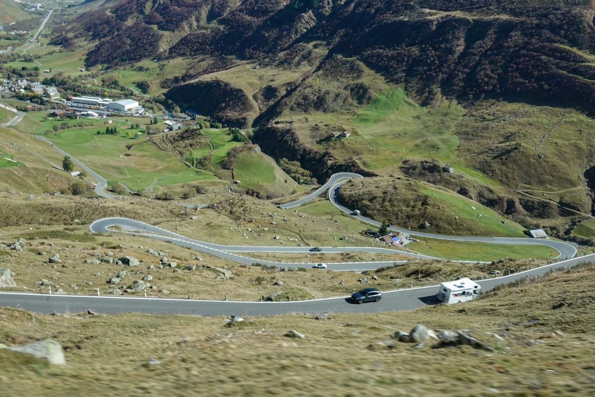
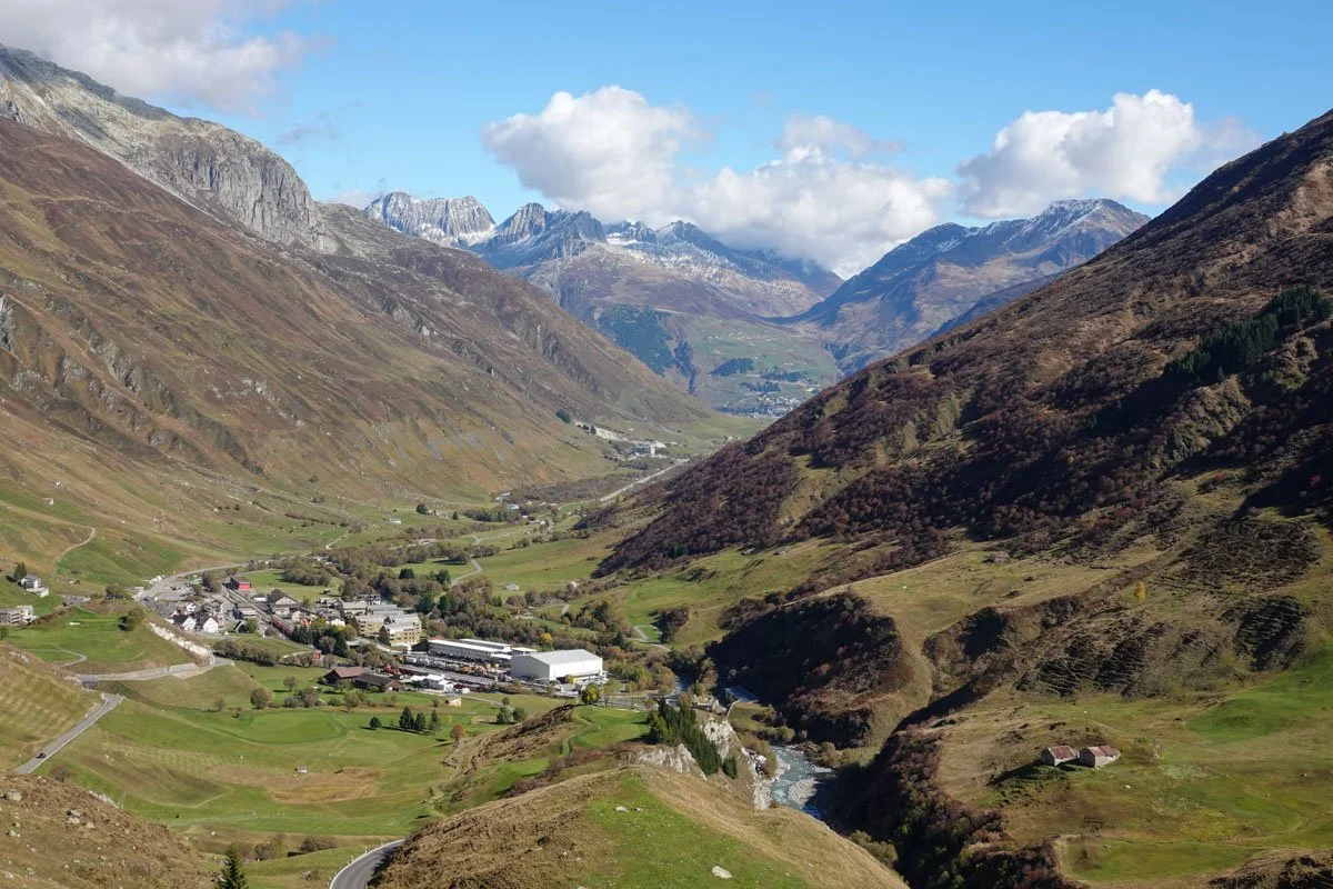
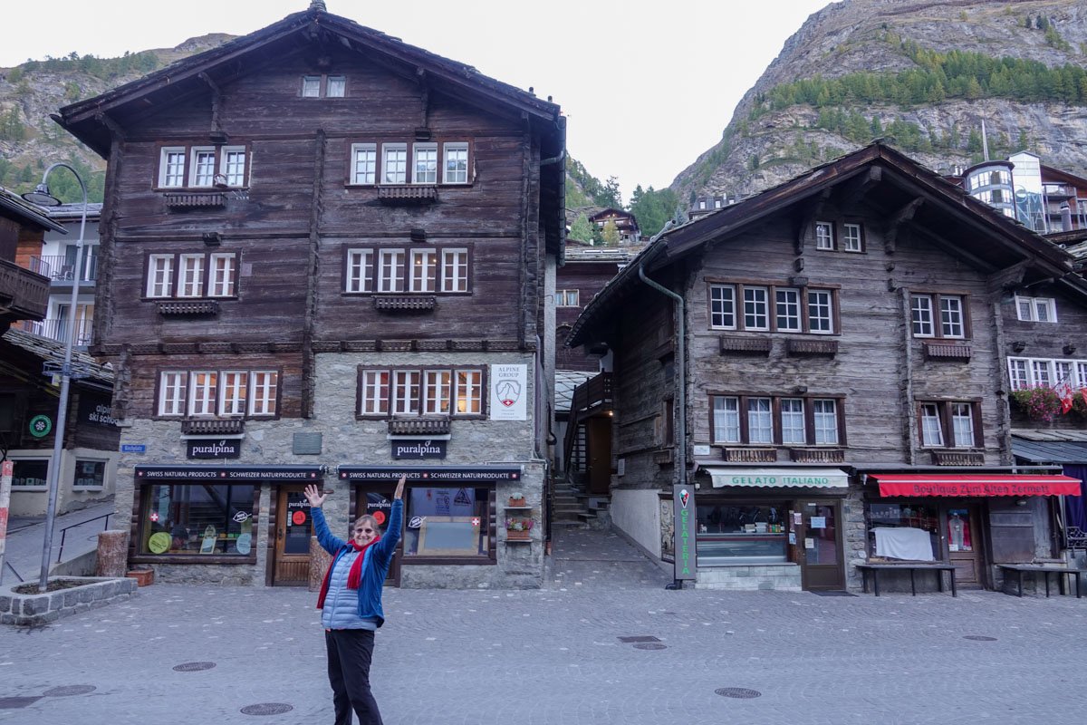
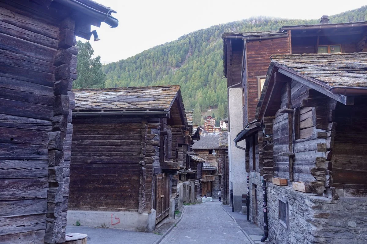
I'll give you a few glimpses of our trip, just so you have an idea of what we saw and where we went.

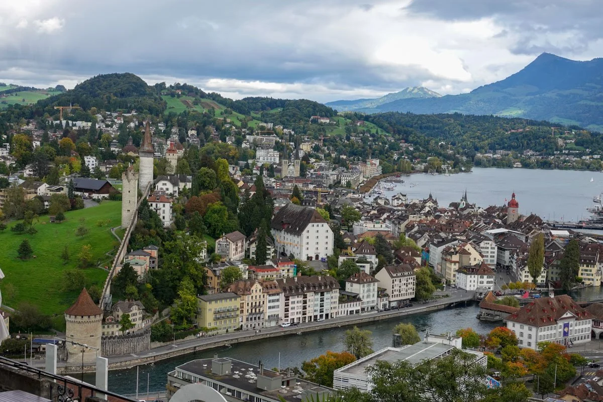
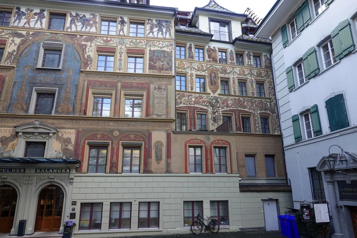
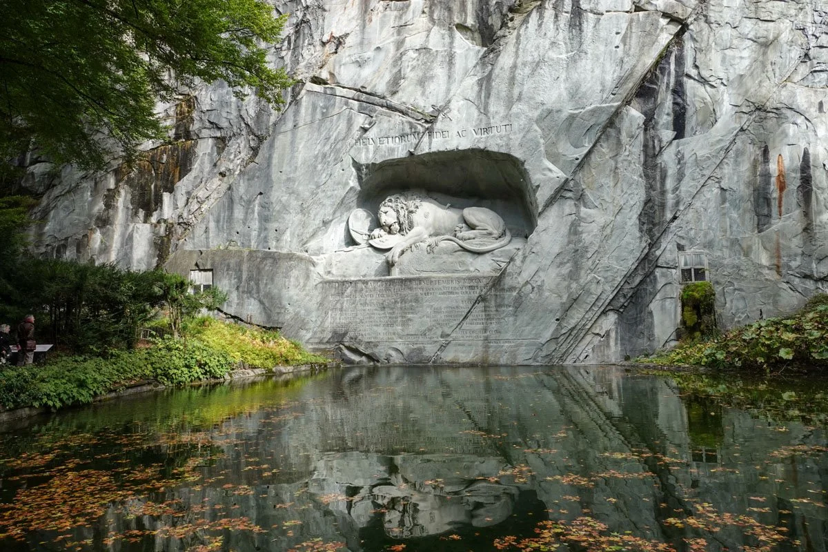
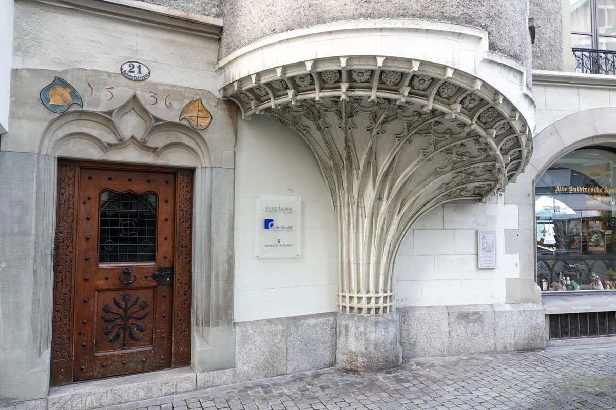
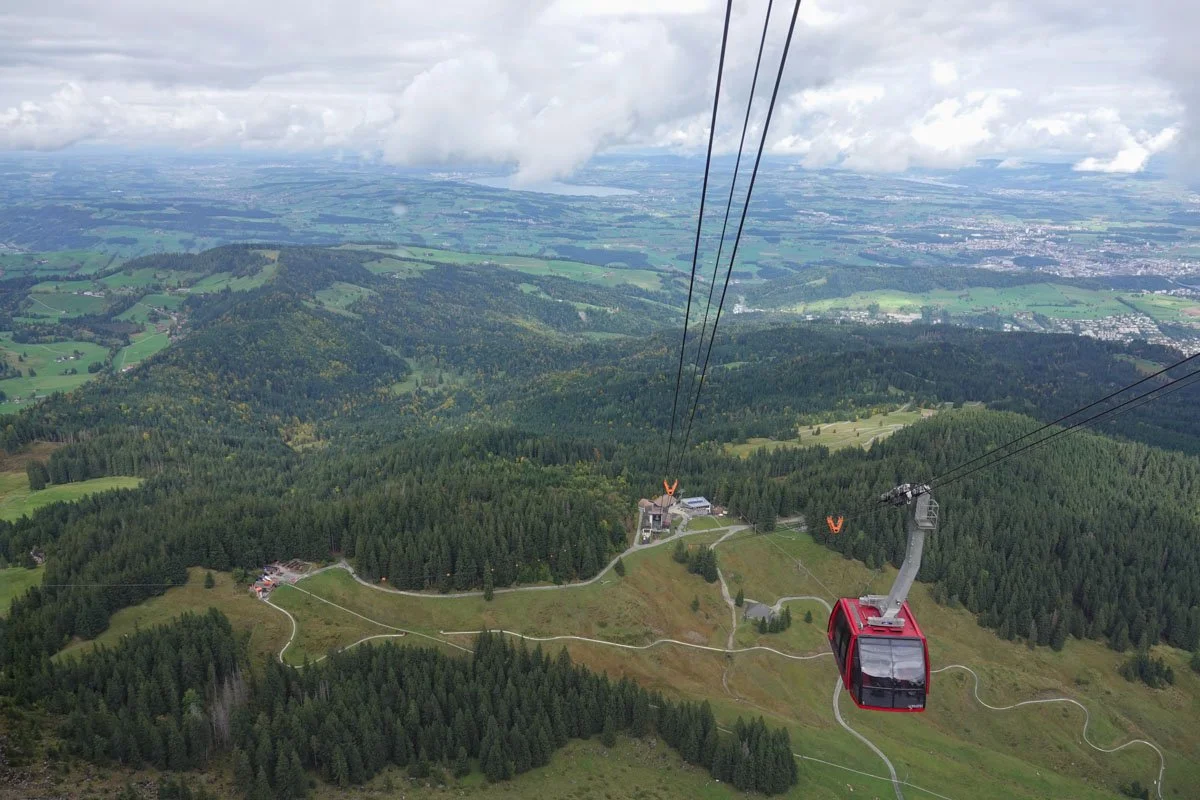
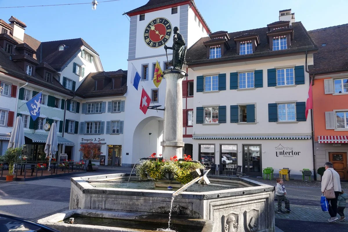
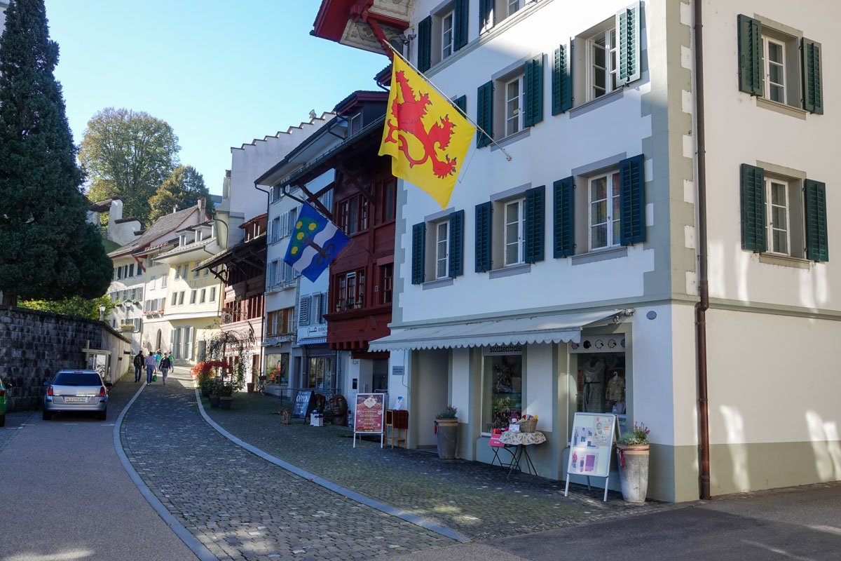
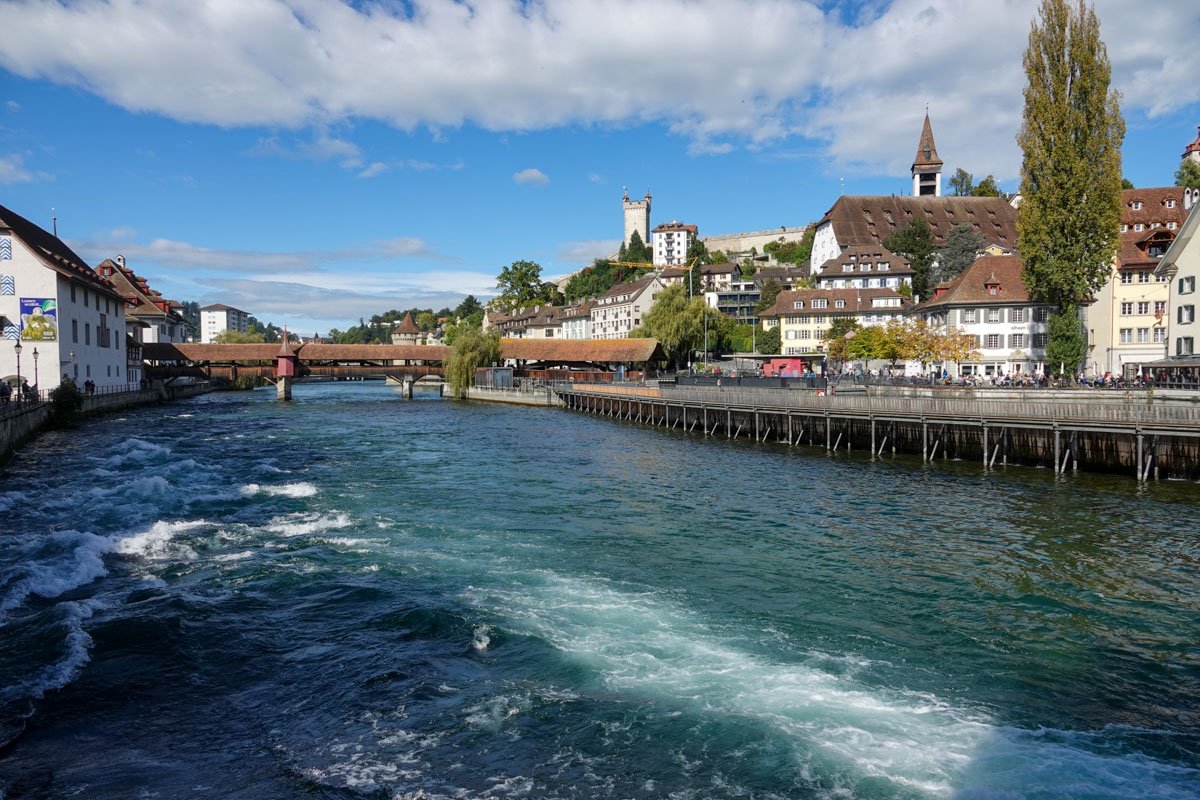
Below was in Lucerne which was our first stopping place in Switzerland. We stayed here for three days.

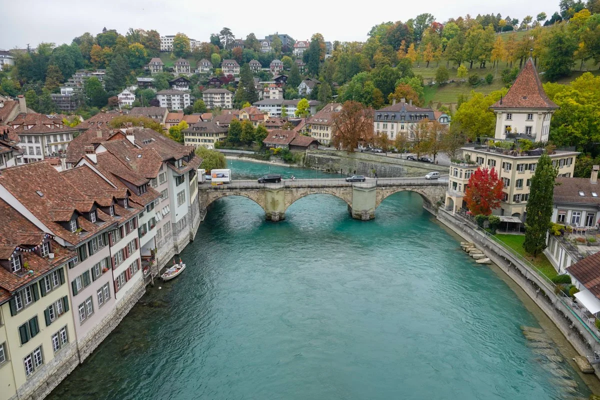
Lucerne is a very beautiful town on the shores of Lake Lucerne and its river outflow, the river Reuss, seen below. 

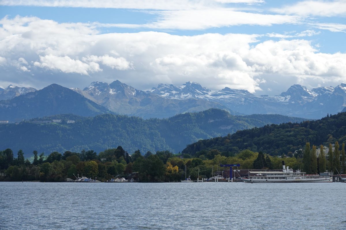
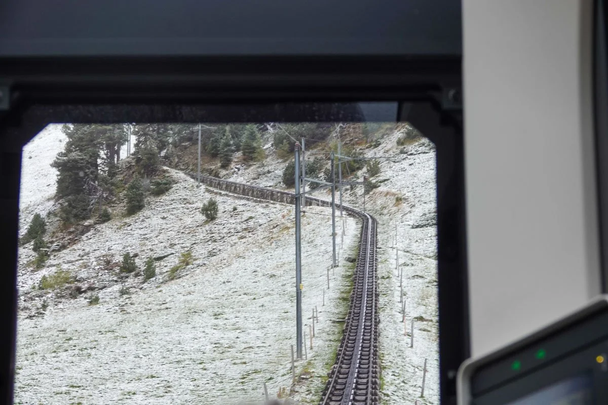
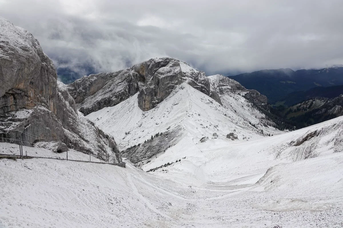
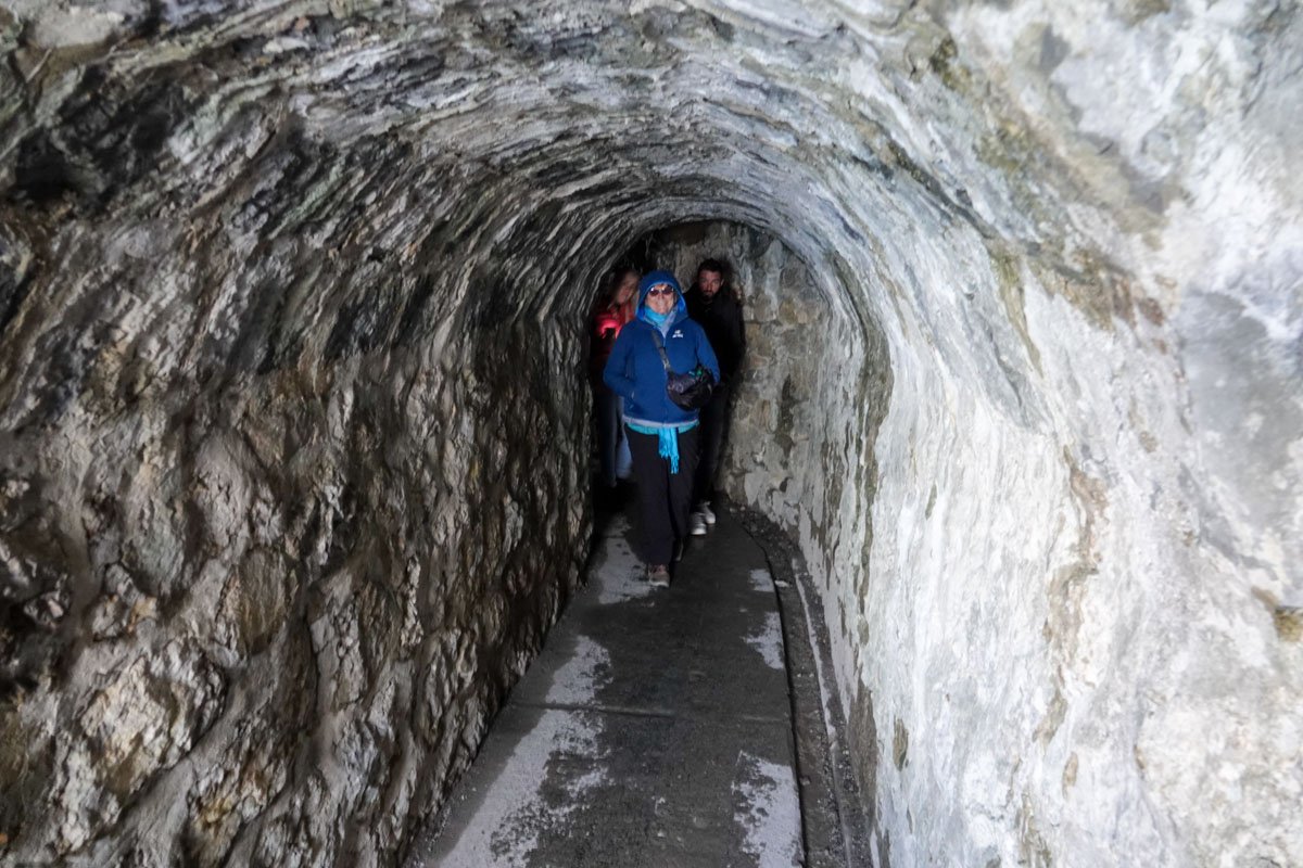
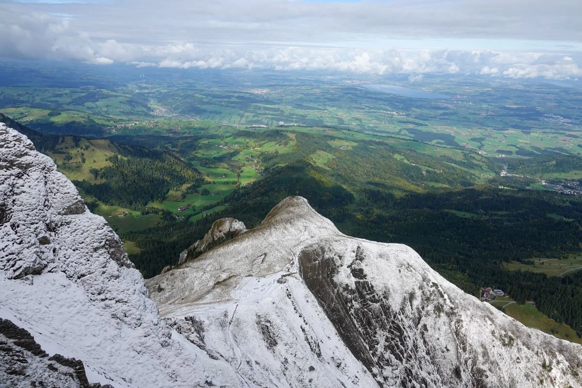
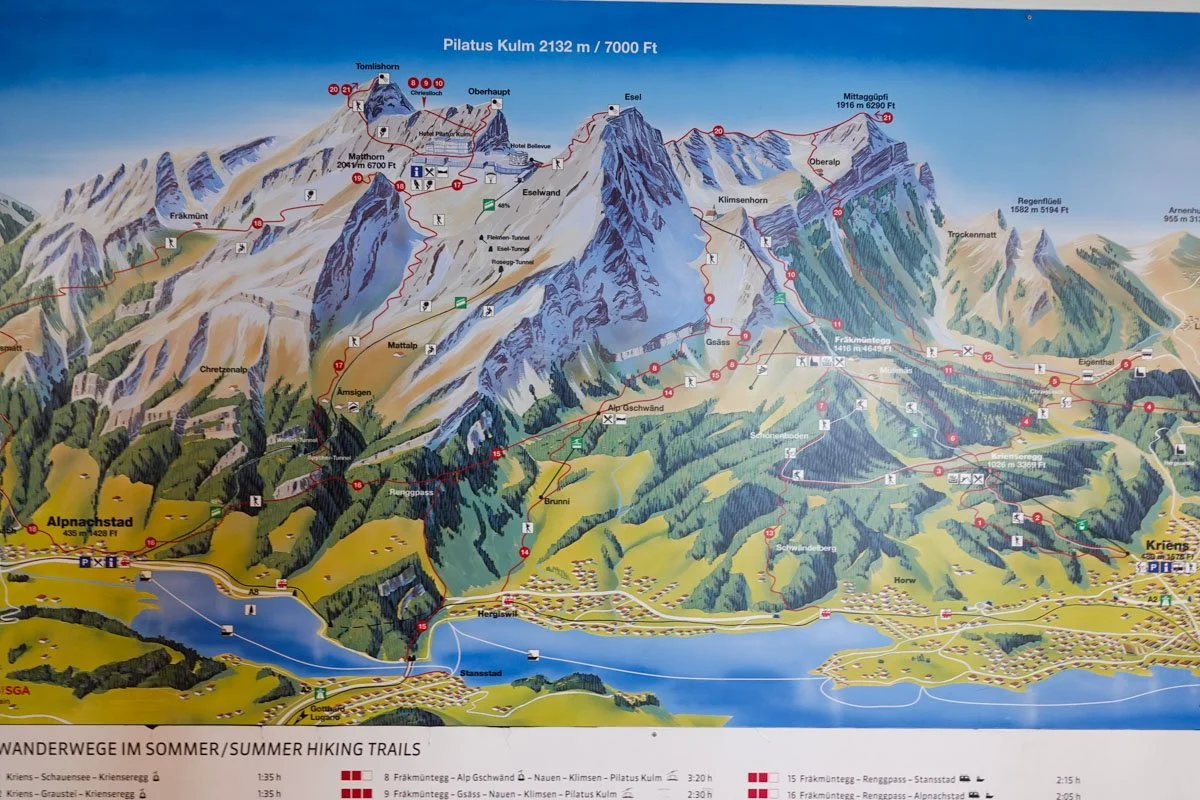
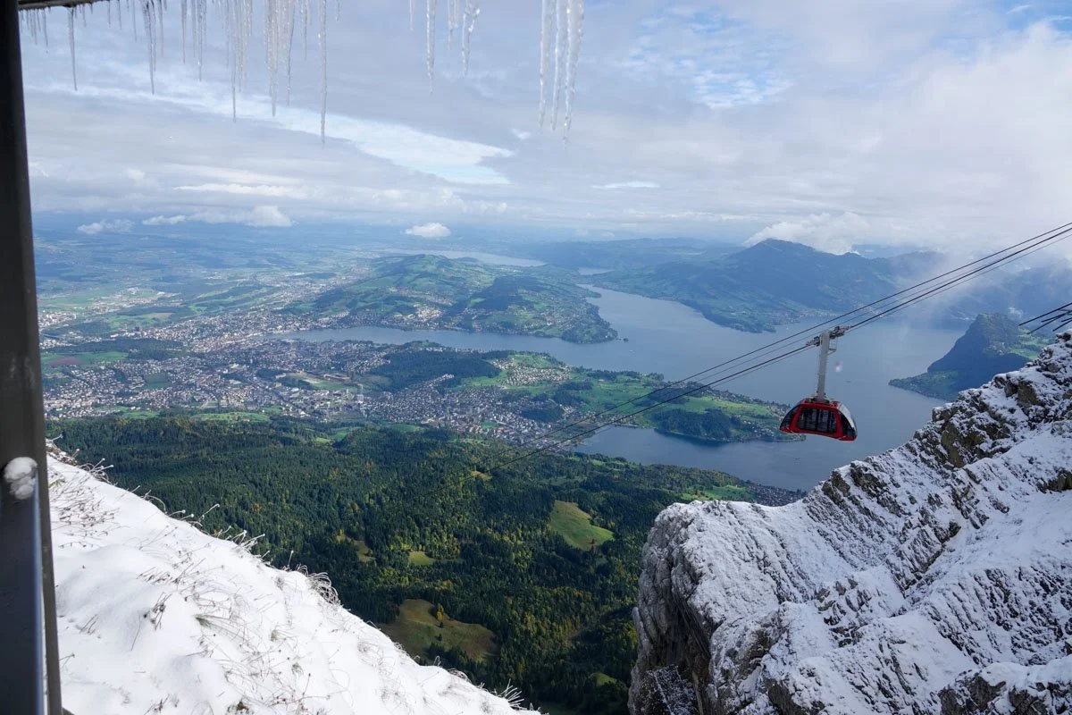
This photo is from Mount Pilatus, looking down on Lucerne and Lake Lucerne.

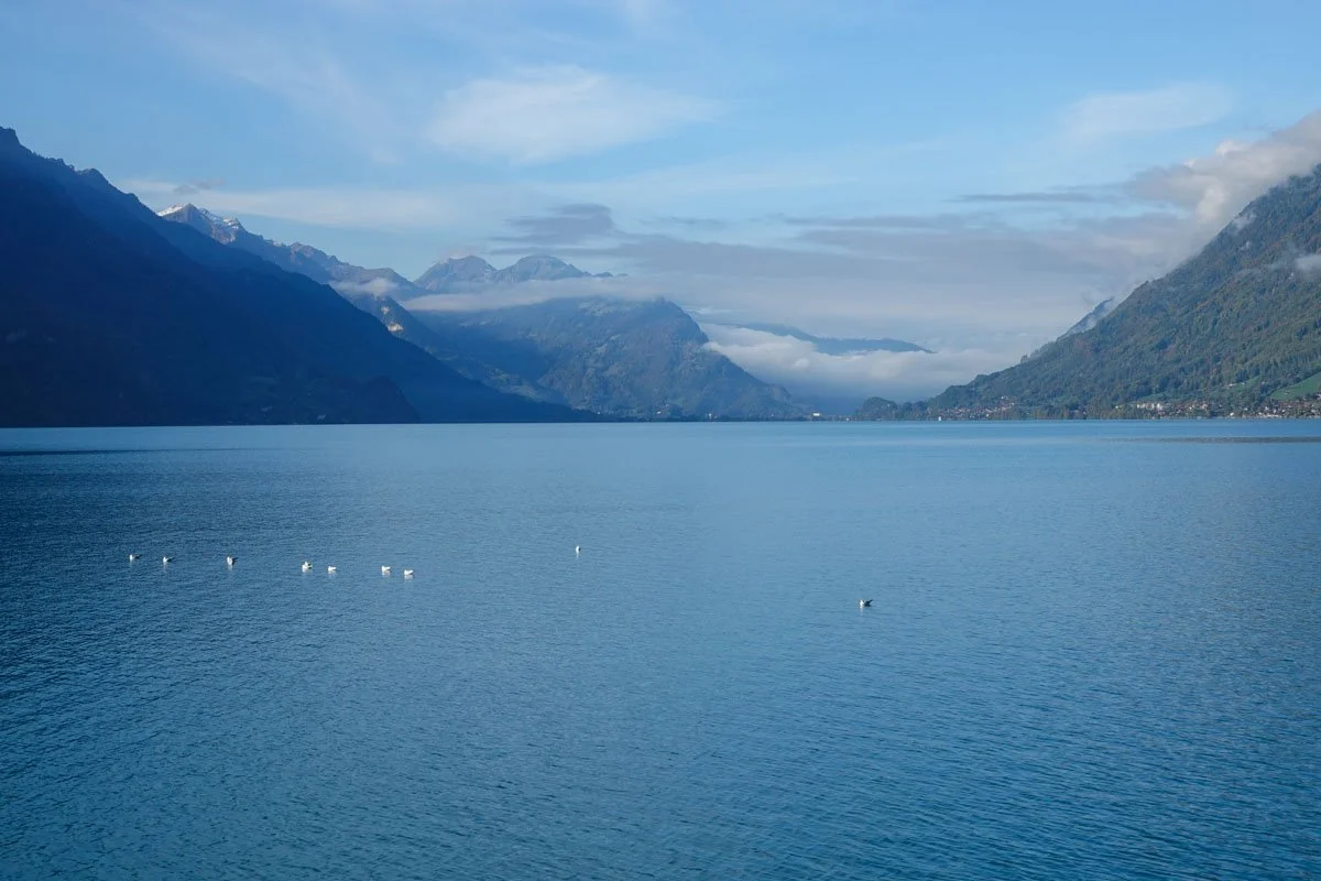
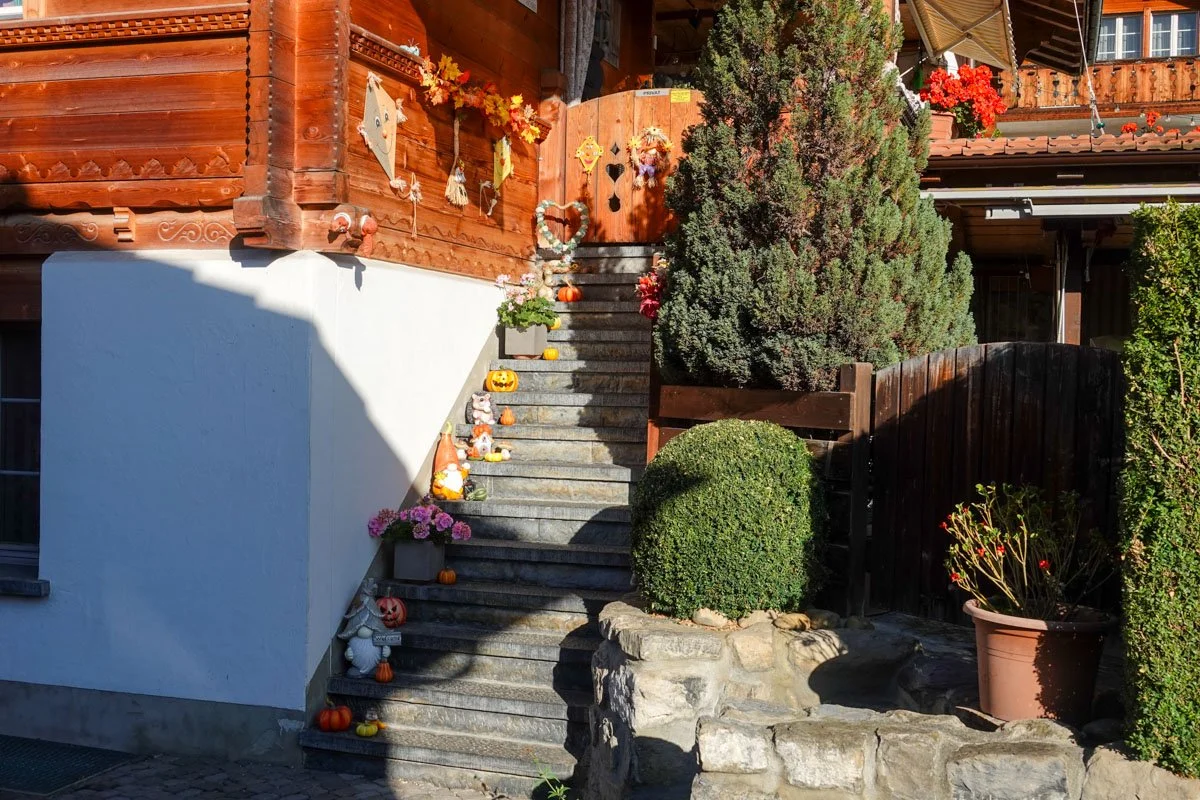
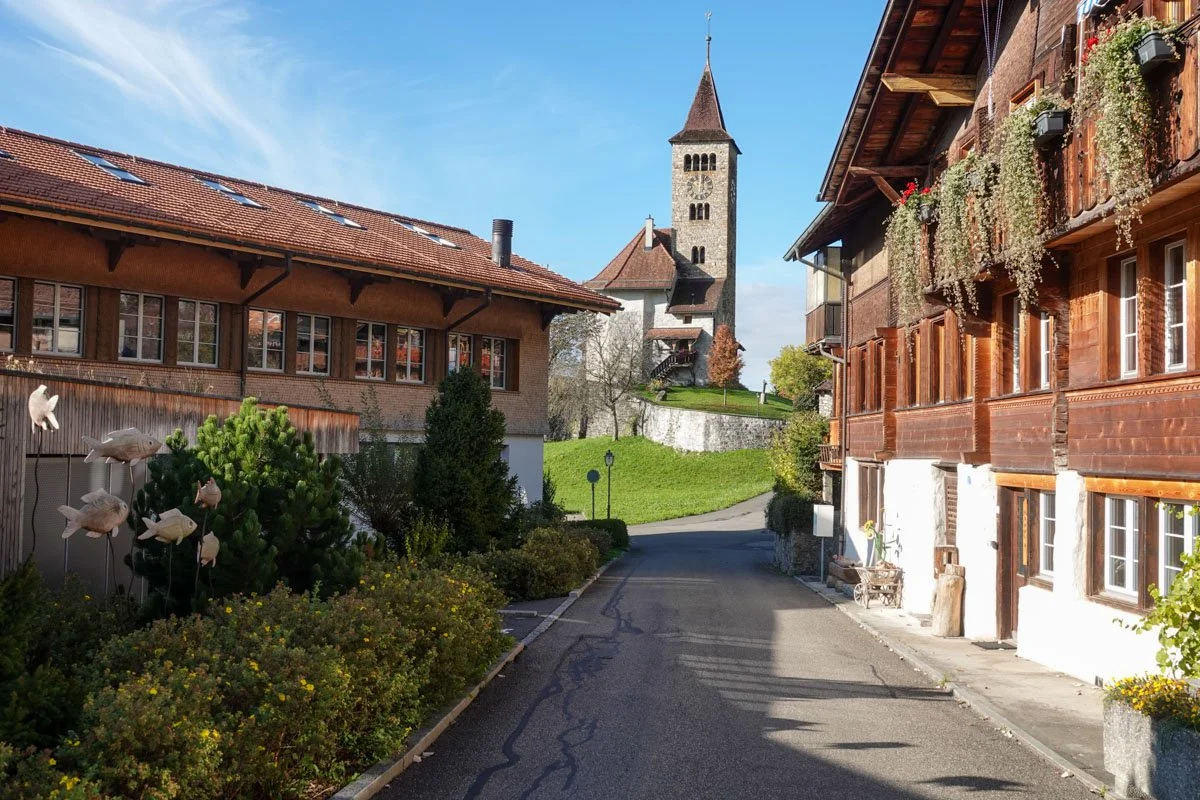
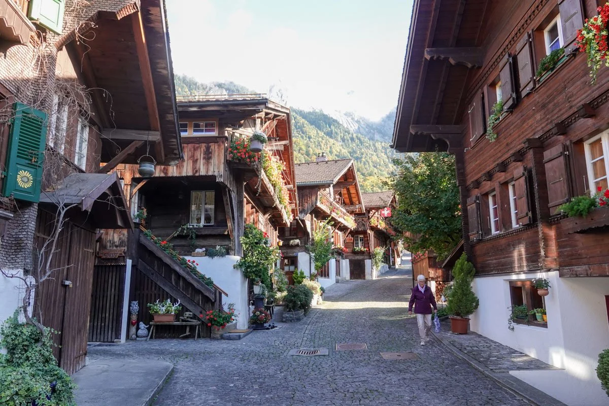
This is the town of Brienz, a small vacation town on Lake Brienz. The town exceeded the cuteness scale.  

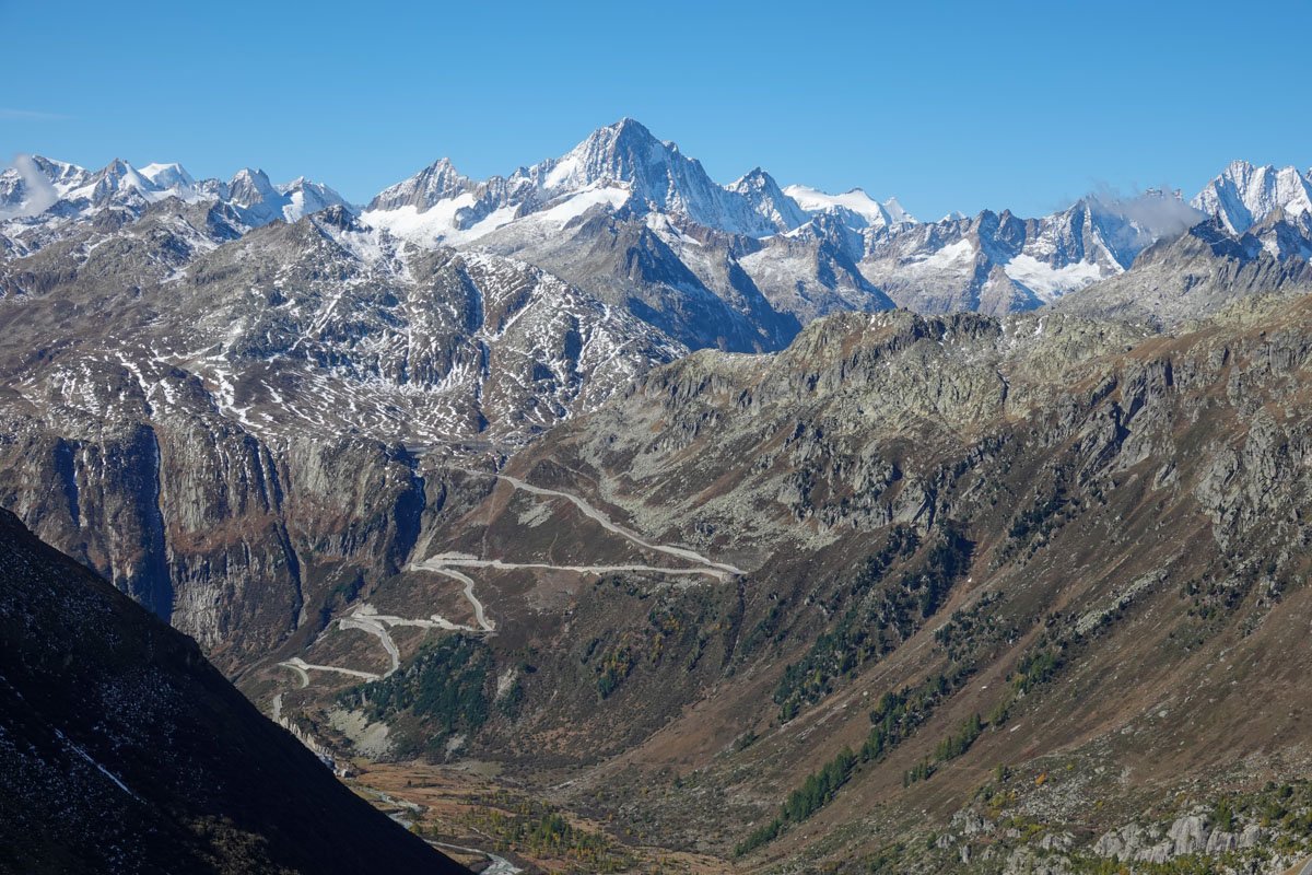
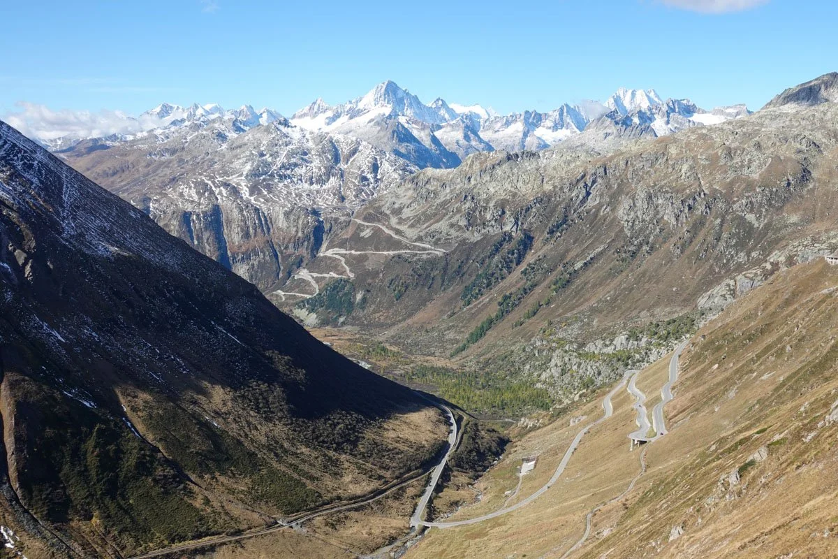
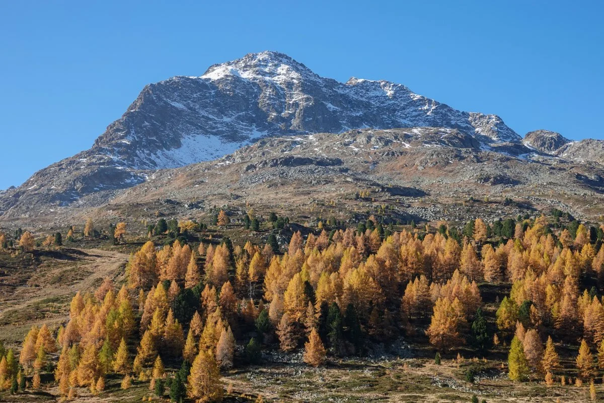
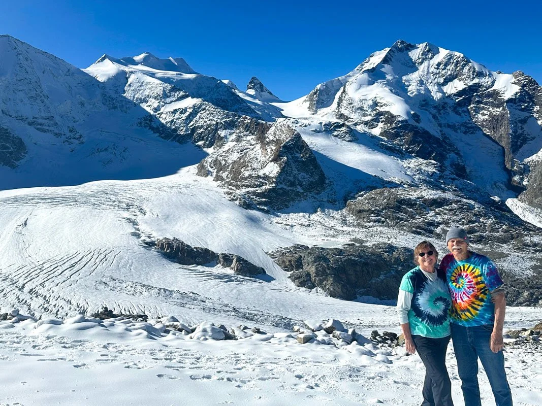
This photo was taken at Diavolezza, a glacial overlook at almost 10,000 feet high and on a very nice day.

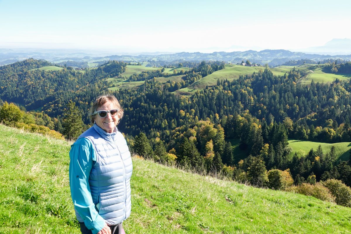
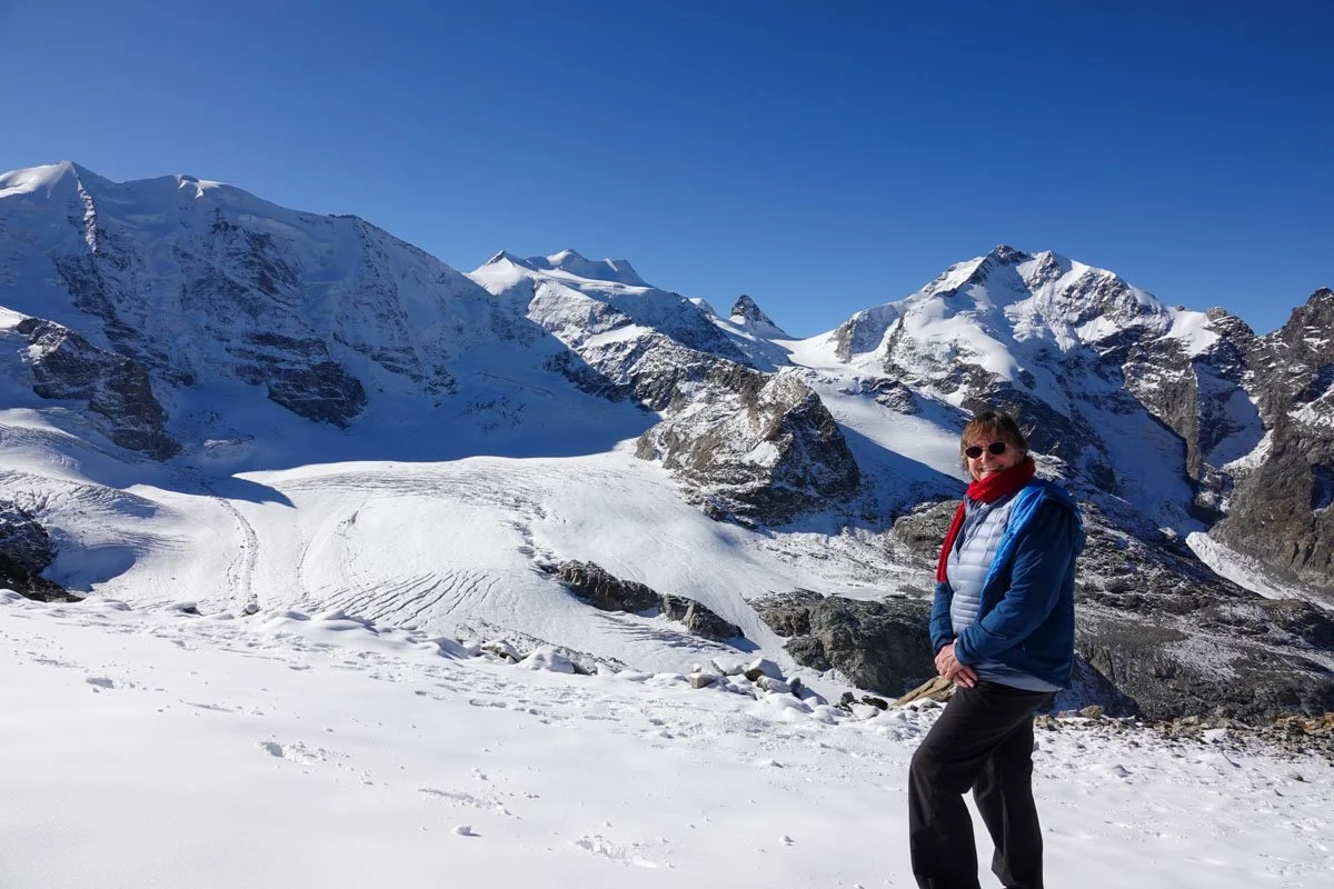
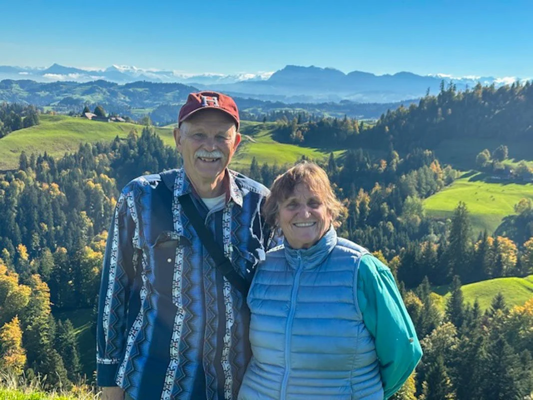
Here, we're on a hike in the mountains on another beautiful day.

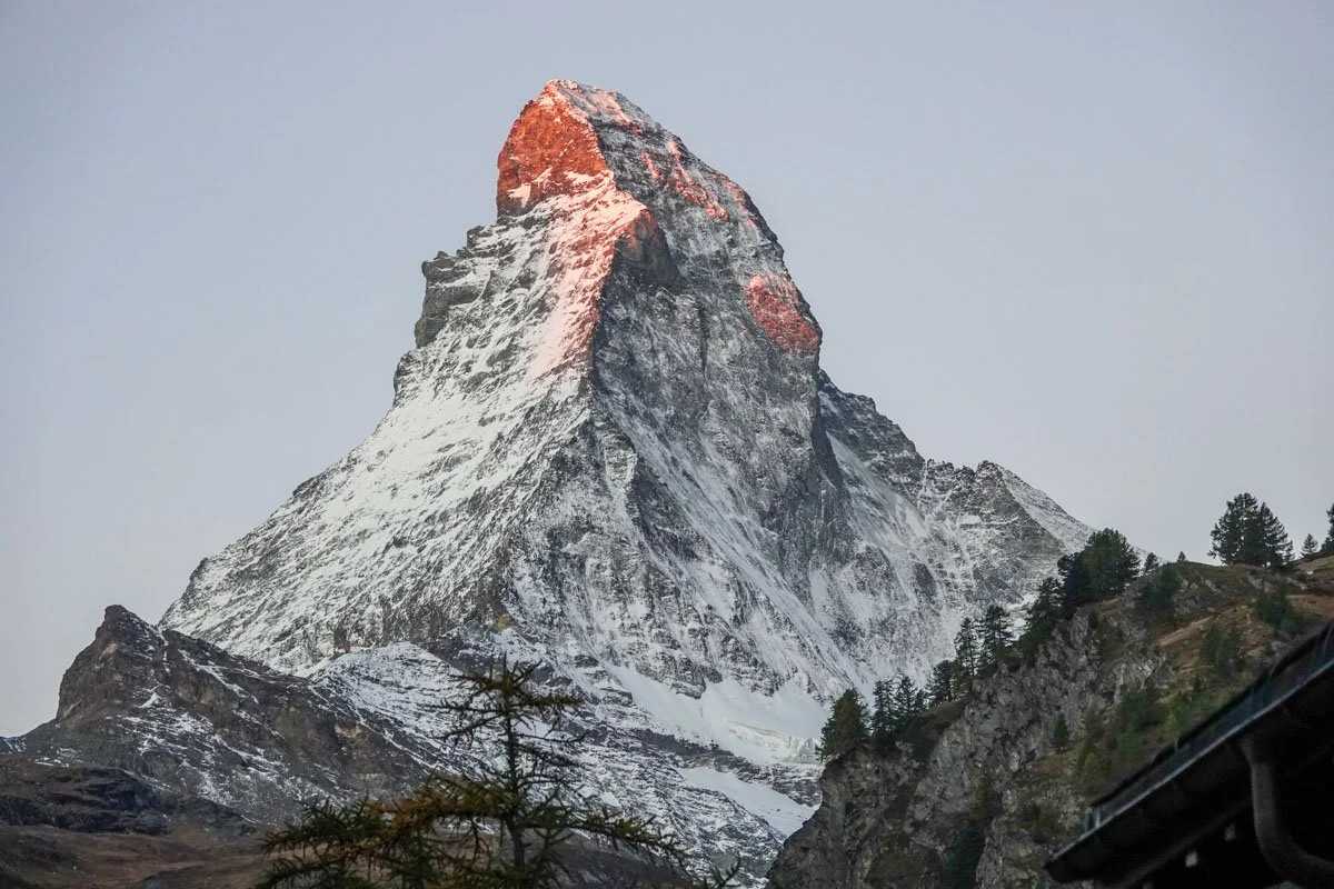
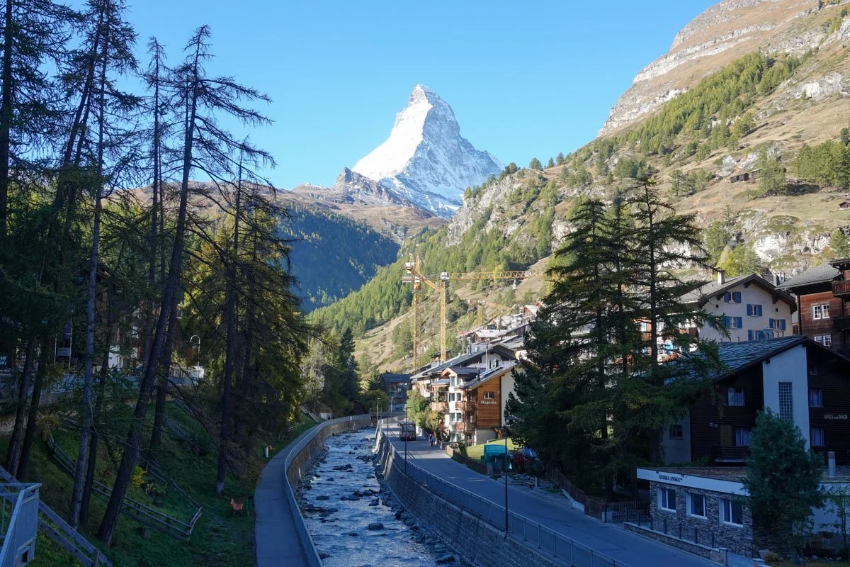
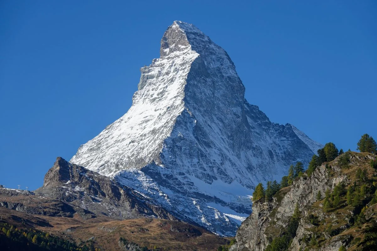
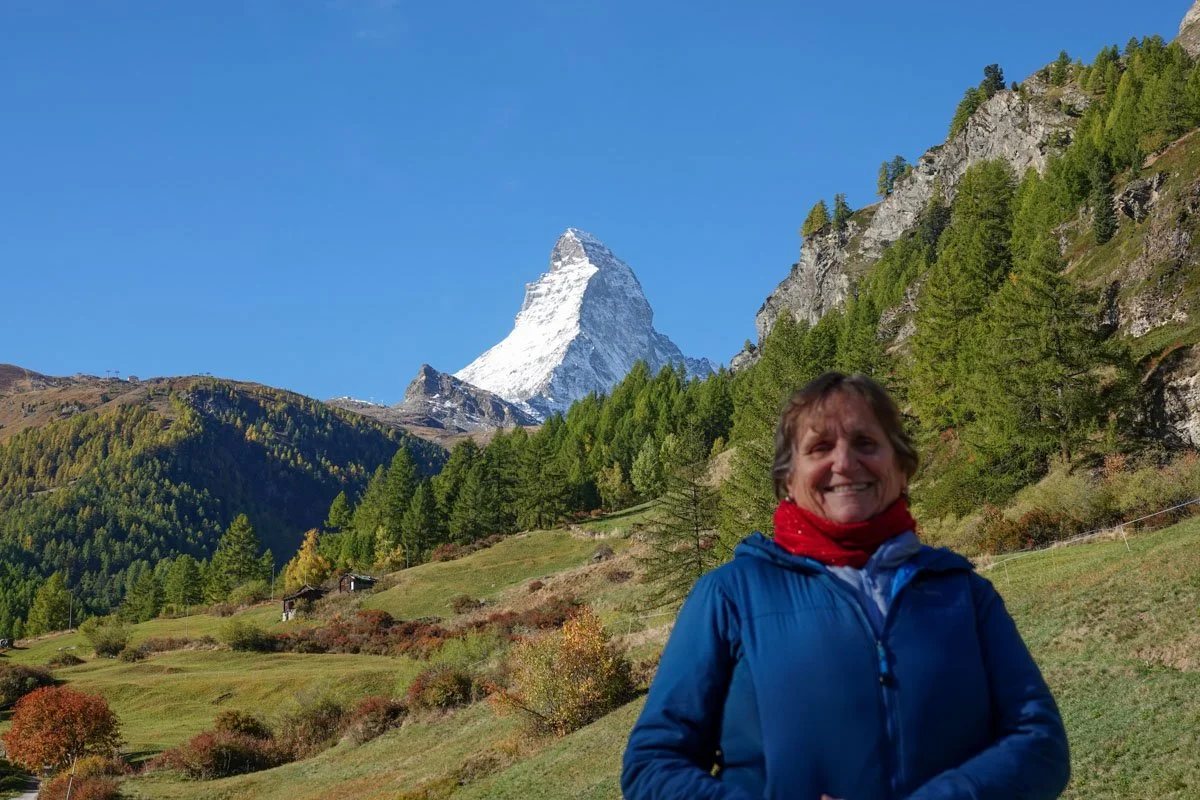
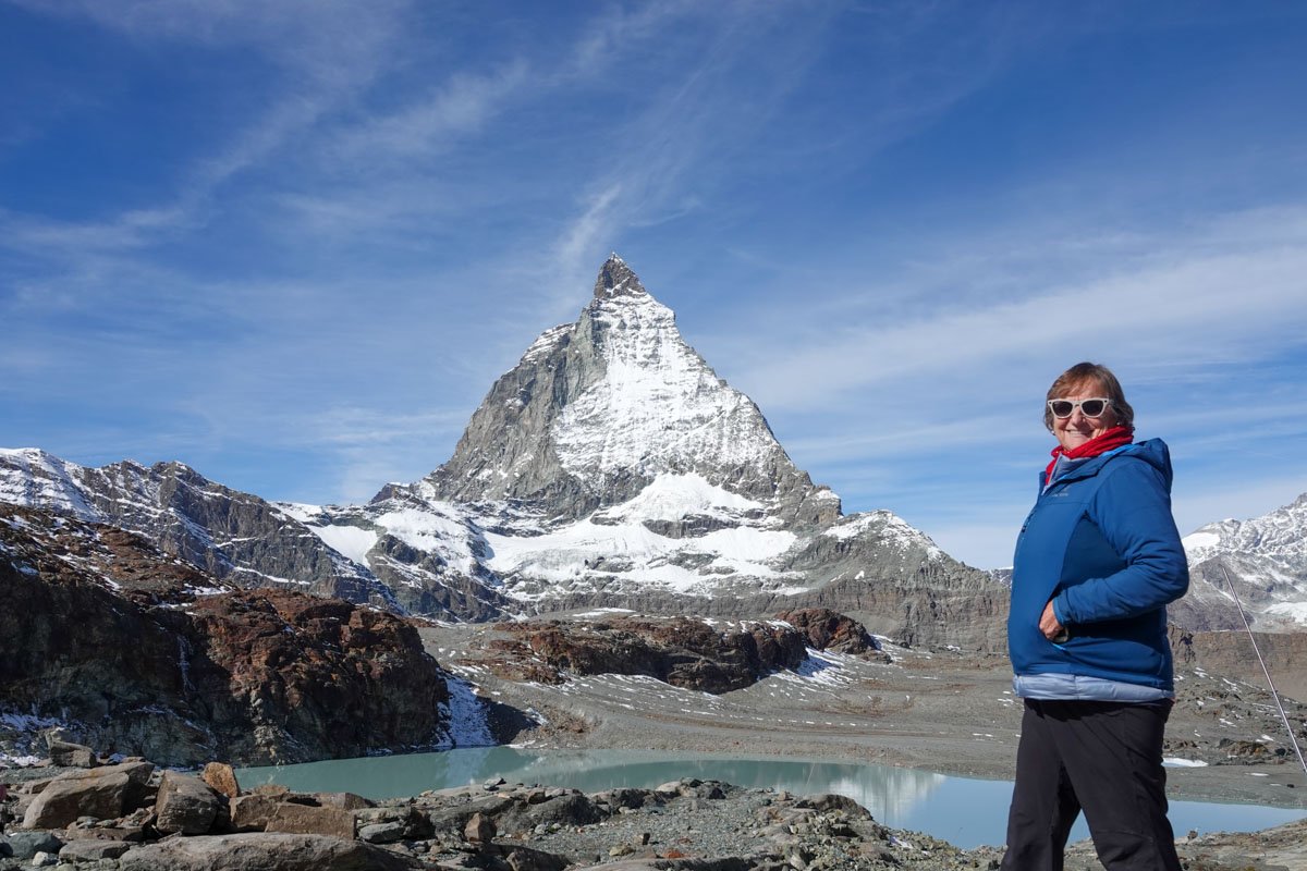
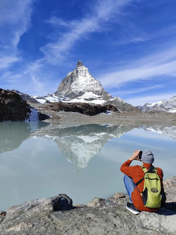
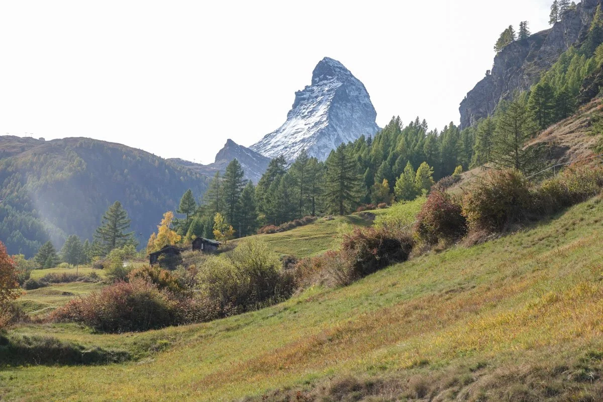
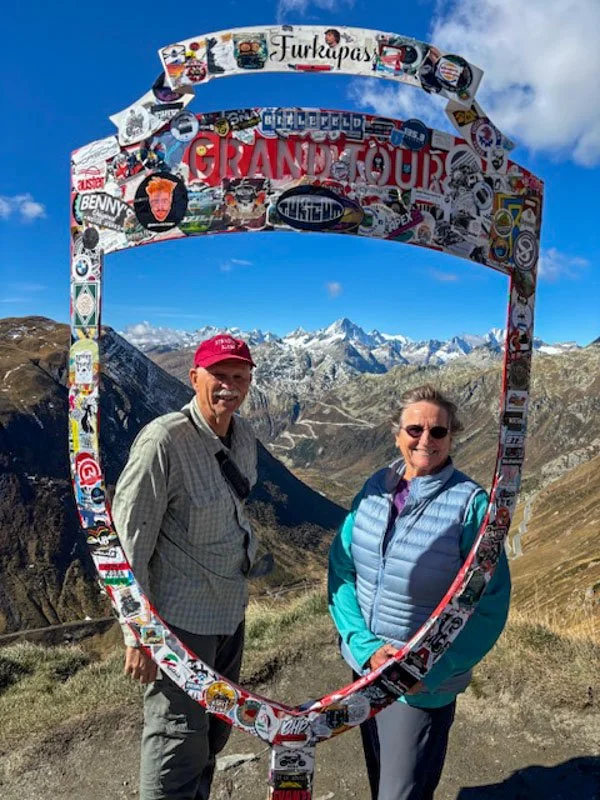
This is the Matterhorn, at dawn, from the town of Zermatt, without a cloud in the sky. The Matterhorn was a trip highlight.

Lucerne

     Lucerne was our first stopping place in Switzerland and it was a fantastic town to visit. It has a population of around 82,000 people but there was a carnival in town that started the day we arrived and the weather was in the 70's, so lots of people were out and about. Lucerne is in the German-speaking part of the country. Swiss cantons (like our states) could decide what religion they wanted the most for their canton. Most cantons chose Protestant religion, but Lucerne chose to be Catholic. 

     Lucerne is the most populous city in Central Switzerland and noted for economics, culture, transportation, and media. It's located on the shores of Lake Lucerne and the lake's outflow, the river Reuss. The town sits right below Mount Pilatus and Mount Rigi in the Swiss Alps. Lucerne has long been a tourist destination and Mark Twain even visited here twice. 

     Lucerne was once a fortified city but most of the medieval wall and towers have long since been removed. We, of course, were interested in seeing and walking the portion of the wall that remains and also climbed up the clock tower. It gave us some great views. In the first photo, you can see the remaining section of the wall and towers on the left side and the parts of the town originally within the walls and the parts now outside the wall. You can also see a small end of Lake Lucerne and the river Reuss that is running out of the lake at the bottom.

     The next photo is just to the right of the above photo. Our hotel was in the center of the photo, about a block from the river. 

     We took an hour boat ride out on Lake Lucerne. The lake is actually very large and fills four separate valleys. The lake has many towns and villages on its shores with regular ferry boats that connect them, as well as roads. Lucerne, like all of Switzerland, is surrounded by the Alps. The next three photos are from our boat ride out on the Lucerne end of the lake.

     In bygone days, the bridges of Lucerne over the river Reuss formed part of the city's fortifications. The Old Mill Bridge was built in 1408 originally and the town's mills were right next to it. The bridge burned partially in 1996 but was rebuilt to include power generation, a fish ladder, and moveable wooden dam parts to keep the lake at a certain level to prevent flooding and allow boat access to all the lake's villages. It's a covered bridge.

     The Chapel Bridge was constructed around 1360 which was later than its water tower. The Chapel Bridge was named so because it ended at a chapel when built, though the chapel has long since been removed. The Chapel Bridge is probably Lucerne's chief landmark. A boat tied up to the bridge to party in 1993 but the boat caught fire and burned down most of the bridge. It has been restored and boats are no longer allowed to tie up to it. We walked across these bridges multiple times and enjoyed each trip across. The Chapel Bridge is below.

     This will be more photos from Lucerne but on a more granular scale. The city offered so much to see and enjoy without even hitting the highlights of the city. We had a great time just wandering around town and looking at the buildings, people and all the activity.

     Lucerne's Old Town has some beautiful decorated buildings. The nicest ones have colorful frescos which depict some of the city's history and culture, such as their annual carnival, the legend of William Tell, historic battles, and the wedding of Canaan. The next two photos are some of the decorated buildings in Old Town. 

     Lucerne did not have indoor plumbing until something like 1875. Long before that, the water they were drinking was very polluted and they had to address the problem. So back in the 1700's, they piped water down to town for drinking from high in the Alps. They have 200 water fountains in town which is where everyone got all of their water for centuries. All the fountains still work and people still use them to fill up their water bottles, including us. They are very proud of their constantly flowing mountain water, and the water fountains are large and highly decorative. 

     The Lion Monument was an interesting stop for us. I always think of the Swiss as being neutral but of course, they were fighters like everyone else in their past. This monument is a sculpture of a dying lion carved our of the rock of a former quarry in the northern part of Lucerne. It commemorates the Swiss soldiers who died defending King Louis XVI during the French Revolution in 1792. It's in a quiet, reflective space, if not too crowded.

     On a side note, a local speaker talked to us about Swiss neutrality. She said that the Swiss people never decided it or voted on it. The Congress of Vienna imposed it on the Swiss in 1815. Following World War I, the Congress of Vienna leaders determined that Switzerland should act as a buffer zone between France, Italy, and Germany. Of course, it is more complicated in today's world. For instance, the Swiss came out and condemned Russia for invading Ukraine and that caused all kinds of havoc with Russia since Switzerland is supposed to be neutral.

     Mills have been operated in Lucerne since the 8th century, right near the Mill Bridge, which is the other covered bridge. Hydro-power is still produced here today. And in fact, we were told that some two-thirds of all Switzerland's power comes from hydro-power. 

     This photo was taken from the Mill Bridge and shows the hydro-power stream, with the main river on the right. You can't see it but there is a fish ladder on the left for fish to move upstream to the lake. I loved how the Swiss incorporated power production, fish care, farming, and so on right in their towns and cities.

     The next photo is a very simple one. This was right across the alley from our hotel. You can see what I mean about wandering around Lucerne and just enjoying the small things to see. A simple door and building wall were well worth the time to stop and stare for awhile.

Mount Pilatus

     From Lucerne, we went up to nearby Mount Pilatus. We weren't sure if we could do it or not as that morning, the power went out in all of Lucerne. We had to make our way down a dark stairway using our phone lights just to get out of the hotel. But the busses and trains were all working.

     Mount Pilatus stands overlooking Lucerne and consists of a range of mountains with the highest peak being at almost 7,000 feet high. The name Pilatus has multiple legends about its origin. One claims that Pontius Pilate was buried here. Yes, the official that presided over the trial of Jesus. But there are other legends about the name as well.  It's generally just called Pilatus.

     We went up the mountain on a cogwheel train, commissioned in 1889. The train climbs up at a maximum gradient of 48 percent, making it the steepest cogwheel train anywhere. It took about 30 minutes to get to the top and we had views of meadows, rock formations, and we even saw a mountain goat. It started snowing on our way up the mountain and they had three to five inches of snow last night on the mountain.

     The first photo is a train photo on the way up. The second is at the top and you can see the train tracks on the left side of the photo.

     On the top of Pilatus, we managed to have clear views which were fabulous. We watched a movie in their theater about the mountain, took lots of photos, and even managed to take a short hike. Our hike was shortened by all the snow and most of our hike was done inside the mountain on a trail.

     One crazy thing about Switzerland as well as Italy and so many other places in the world is the placement of churches. I cannot imagine the thinking about where to put some churches in the world way back then. But in this part of the world, the mountain tops seemed to have been a highly desired location for churches.

     Can you find the church that I'm talking about in the next photo? It's on the mountain in the snow. 

     It has a red steeple. I can't imagine how they could have ever had a congregation at this church.

     The Swiss people seem to be real outdoors people. Outdoor activities were evident wherever we went. From riding bicycles, boating, skiing, hiking, to everything else, and usually at elevation. Maybe that's why I never saw any overweight people in Switzerland.

     The next photo is a photo of a map at the top of Pilatus. If you can see closely enough, they have hiking trails that go right up the mountains in many places. These have to be really difficult hikes but evidently not too difficult for the Swiss. Plus there are ski runs and many other activities.

     We went down from Pilatus on the north side, using a gondola cable car. It was a fast ride with great views. We stopped at an intermediate station, called Frakmuntegg. You can see one of the red cable cars on the right side of the photo. Lucerne is below at the end of the lake.

Frakmuntegg for Fun and Food

     There was an intermediate gondola stop on the way down from Pilatus and we stopped there. It's basically another location for hiking and other outdoor sports. They also had a restaurant where we ate some lunch. 

     But first, for some real fun. The first photo was on our way to Frakmuntegg on the gondola. You can see a lot of the Swiss Plateau but if you look down on the side of the mountain near the bottom of the photo, you can see a ribbon of silver going down the mountain. That's a toboggan run. And yes, I couldn't resist taking a toboggan ride down the mountain.

     A fellow traveler took the first photo of me starting down my toboggan run. The company guy said that we were not allowed to take photos while doing our toboggan run but let's face it, some people follow directions better than other people, as you can tell from the second photo.

     There was a cafeteria at this stop on the mountain and we got some lunch. I had the meatloaf, fries, and a German beer. The meatloaf looked more like a giant slice of spam but it tasted good. It just didn't look like our meatloaf. I had some pear custard for dessert.

     Vicky had some rosdi-sausage and cheese and apricot custard pie for dessert.

     Besides the toboggan run, they had other outdoor things to do at this stop plus lots of hiking trails.

Willisau

     We drove from Lucerne to Bern on this day. It was a beautiful drive and we seemed to be taking the back roads. Willisau was our first stop and it was an unscheduled stop for us. There were Roman settlements near here in the 2nd and 3rd centuries. In 1302, three Hasenburg brothers founded the town as a fortified town. They were granted the rights by the Habsburgs. Later, they were granted the rights to hold markets in town.

     Today, Willisau is still a small town with perhaps 8,000 residents. You can still see the entrances to the fortified town, under the clock tower. Willisau is also in the German-speaking region of Switzerland. The surrounding area is mostly agricultural but also very forested.

     We were told that Willisau hosts an international jazz festival and one of the oldest carnivals in Switzerland. We prowled around and had a very nice visit here, but a relatively short one.

     I'll start with a few photos of the main part or their Old Town area. If you look beneath the clock tower, you can see the thickness of the old town wall. We were here early in the morning, so the town was very quiet. The two women in the photo are part of our nine-person tour group.

     Every town that we visited had water fountains where everyone used to get all their water and where people still fill up their water bottles.

     Willisau is famous as the home of the Willisauer Ringli, a traditional Swiss sweet cookie. They make dozens of different types of cookies. We visited the factory and store, saw their cookie making operation, and tasted handfuls of their cookies. As Vicky was listening to our guide, I was off taking photos. I came back to Vicky and she said, "Hold out your hand, palm up". I did that and she put a cookie in the palm of my hand. Then she told me to smash the cookie with my other elbow. I did that. I then looked down and saw the cookie broken into 4 pieces. Vicky said that because of that, I would be allowed to live in Willisau. She said that was a requirement of the town to live there. She did it but the cookie didn't break into 4 pieces, so she couldn't live in Willisau. I only got a photo of Vicky taking a cookie from one of the cookie tasting bins. It's an interesting tradition but I decided not to live in Willisau.

     We visited a church in town. Swiss towns tended to have lots of churches, too many to keep track of. But in this church in Willisau, they had pictures along the side walls. The picture below was just to the left of the main altar. I was surprised to see a picture of people playing cards, and gambling, in church. They had several such pictures, and the idea was that it was bad to gamble and you shouldn't be doing it. 

     We were walking down the main street when Vicky stopped at the Choclatier below and we had the following conversation.

Vicky: "I'm going to stop in here".

Bill: "That's no surprise to me."

Vicky: "Why do you say that?"

Bill: "Because I'd rather walk a dog through a forest than walk you past a line of chocolate stores."

Vicky: "Why would you say that?"

Bill: "Because the dog wouldn't stop at EVERY tree!"

Swiss Central Plateau

     This was on our drive from Lucerne to Bern. Our guide said that this was the Swiss Central Plateau. We stopped at one point at the end of a side road and took a mile hike along a ridge line. To say the least, it was a beautiful day and the day was matched by the scenery.

     We had great views all around and were serenaded by the near constant sounds of cow bells. Our guide said it was great mushroom country. The yellow conifer trees are larch trees which are the only conifer to lose its needles in autumn, lending nice color to otherwise mostly green forests.

     Most of the area is agricultural. They have lots of cows but also grains for people and hay for animals. They do grow some row crops like corn but as you can imagine, there isn't a lot of real flat ground.

     I loved the forests here, and in this area, the forests were actually quite diverse in terms of the types of trees.

     Logging and lumber are big industries here which was no surprise as they have an abundance of forests.

Bern

     Bern is the capital of Switzerland and the fifth most-populous city. Bern is located on the Swiss Plateau. The Old City, or the original city, was located on a hilly peninsula and was surrounded by the Aare River on three sides. Our local guide said that Bern became the capital in 1848. We had a local tour guide for one morning and spent more time wandering around Bern on our own. It was a nice town to visit. 

     We found out something interesting from our local guide. If you notice how wide the street below is, it has a story. But first, the drinking fountains.

Drinking fountains were the only source of water available in Bern until 1860, so after they became the capital city. The water is still good today.

    Remember that Bern was surrounded on three sides by the Aare River. Way back in time, the city only built a protective wall on one side, the one side without the river. Outside of the protective wall, they built a moat. In the photo above, the wall was the right side. In the photo below, the city wall was on the left side. 

     In 1405, Bern was destroyed by a fire. The town was trying to decide how to get rid of all the rubble of the town in order to rebuild. Someone came up with the idea of putting all the fire rubble into the moat which was right there. They filled up the moat with all the fire rubble and today, it is a main street and a nice wide one too. I thought that was quite creative, though it left them without a moat for protection. I liked their clock tower too. 

     The Cathedral of Bern was started in 1421, but then it started to lean. All the problems caused it to not be completed for almost 500 years, in 1893. It was dedicated to Saint Vincent. It has stained glass windows that were made from 1440 to 1460. It's a Catholic church.

     The next photo is the Parliament House. It was built in 1902 but over time, an additional wing was added on both sides of it.

     The next three photos were taken as we walked around town. You can see the river in all the photos since the river is on three sides of town. Bern is a very nice place and the fall color was nice too, though we were a little early for full color. You can also notice the beautiful color of the Aare River, courtesy of glacial runoff.

     There's a story that the founder of Bern decided to name the town after the first animal that he saw. The first animal was a bear which is the symbol of Bern. I think in some language, bern equals bear. At any rate, Bern has had bear pits throughout town since the beginning. But bear enthusiasts or animal lovers objected to them in small pits. So today, Bern only has one Bear Park and only has three bears. The main area is big enough, but it has a bear tunnel that allows them to go to a hillside overlooking the river, so they have room to roam. The bears are a very popular attraction in Bern. Below are two of the bears in the main section of the bear area which also has a hidden cave area for them to be in if they want to get away from all the tourists.

     I will confess that I was disappointed at first when I saw this beautiful building with "Casino" on it. It turns out that it is their Concert Hall and when it was built, our local guide said that casino just means "a place for entertainment". It was never for gambling.

     Albert Einstein lived in Bern for three years. It was during that time that he developed his Theory of Relativity, amongst other things. He lived at Krarmgasse No. 49 in Bern and that house is now a museum to showcase his life and work, restored to the period when he lived here.

     Additionally, we found a statue of Albert Einstein sitting on a bench in town. We had nine people in our Switzerland tour group. Eight of us took a photo sitting on the bench next to Einstein. Need I say more? 

     Wandering around town, I found lots of houses to take photos that appealed to me. The one below was down near the river.

     Most things in Switzerland are on the expensive side, including food. We, however, found that it could be quite cheap to get a very nice snack to keep us going as we waltzed around town. You can see our choices in the bakery behind Vicky. Our only problem was that the birds thought they were entitled to a share of our food.

     The Rose Garden is a very nice park. It used to be a cemetery. Bern seems to have a tradition of people going to the Rose Garden to watch the sun as it sets over the town and the river. We enjoyed the experience with a nice crowd of people.

Murten

     One afternoon in Bern, we hopped on a train and went west to the medieval town of Murten. It is located on the southern shores of Lake Murten. It is a mostly German speaking town, but in a French-speaking canton. The oldest archaeological evidence of a settlement here go back to the Mesolithic period of 8200-5500 BC. The evidence is mostly small shards of flint from that era used for tools and weapons.

     It goes without saying that there is a lot of history here. We had an afternoon visit and enjoyed it very much. Lake Murten looked like a good sized lake to me but it's actually not that big by Swiss standards.

     Our entrance into town looked like we were entering a medieval town. It has picturesque architecture, cobblestone streets, and views of the lake.

     At one point, we walked back outside of the old town wall for our guide to point out some history. He showed us some canon balls that were shot into the fortified wall and have remained there. I didn't argue but it looked like some more recent cement work than the Middle Ages.

     We admired Murten Castle and we walked a portion of the old town wall and climbed up the central tower. Walking old town walls is always one of my favorite things to do in medieval towns. The wall is on the right and from there, we had a good view of the lake, behind the town.

     We ended our town tour at the Hotel Crowne. We had a talk with a winemaker in the basement of the building which was an ancient room. Then we went to the dining room where we tasted four wines from the Vully wine region which is across the lake from Murten. We had a nice view of the lake. 

     Wine tasting was followed by dinner. We had fresh bread and salad, as usual. I had pan-fried rump steak with mushroom sauce, dumplings, and vegetables. We had vermicelli for dessert.

Brienz

     On a travel day from Bern to Zermatt, our first stop was the small town of Brienz. It is on the climb up the Alps and is a small vacation town on the northern shore of Lake Brienz. Settlements here also go back to the Neolithic and Bronze Ages. This area of the Alps are among the sources of both the Rhine, Rhone, and Danube rivers which eventually reach all the way to Belgrade and Vienna.

     Switzerland is truly a land of lakes. Somehow I only thought about the Alps before coming here but the lakes are abundant. This is Lake Brienz.

     The main economics of Brienz are tourism and woodcarving. Our guide said that the town is so incredibly cute that we were lucky to be visiting here after the tourist season. He said that during the season, it can be a bit of a zoo. I could understand why.

     They know how to carry out the cuteness theme in Brienz as many of the houses and yards were well decorated.

     If you look closely at the rocks on the mountain behind the town, you might notice a long waterfall coming down the rocks on the left side.

     We spent an hour or so walking around Brienz but missed a fall highlight. Our guide said that the people in town bring the cows down from the mountains in the fall and have a big parade as the cows come back into town, all decorated with bells, flowers, and such.

     On another side note, below you can see a church in Brienz. I was struck by how many churches they had in some of these very small towns. Our guide said it was because the same denomination might have a different church for German, French, or Italian speakers.

Furka Pass and Continental Divide Drive

     We continued our drive up the Alps leading to Furka Pass. The road has many tunnels which are common in Switzerland. The pass is in the southern Swiss Alps, and we were heading south. The elevation at the pass is almost 8,000 feet high. There was not much snow at the pass but the mountains around the pass still had snow. 

     On a side note, these mountains have lots of both lakes and reservoirs. The Swiss get about two-thirds of their electricity from hydro-power generation and they are concerned about global warming and shrinking glaciers reducing their hydro-power production.

     We crossed the continental divide on this drive, which our guide described as a "dramamine drive." This area is the headwaters of both the Rhine and Rhone rivers. 

     The drive was mostly switchbacks and was a windy and wild ride. The scenery was fantastic but our viewpoint changed back and forth so frequently that it was a little hard to enjoy. The pass is in the middle of the first photo between the near and far mountains on the right. You can also see a portion of the road.

     From above, we kept coming south and in the next photo, you can see that we had to drive back up out of the small valley which was also a switchback road.

     Does the photo below look familiar to you?

     How about this photo?

     How about now?

     And lo and behold, I found a "Bond girl" standing right along the road...

Glacier Express Train

     From the Furka Pass, we drove down to the town of Andermatt. It's a scenic alpine village. We wandered around town and ate some lunch. It's really beautiful country and fun to just walk through town with its cobbled streets, interesting architecture and curious stores.

We boarded the Glacier Express train in Andermatt. It's billed as the slowest express train in the world. We were also told that it is the most scenic railway trip in Switzerland. The train was so smooth that there were no worries about spilling a drink. It had nice big windows, so we had great views of everything we passed.

This train ride is about the trip, not the destination. It goes through the heart of the Swiss Alps. We crossed hundreds of bridges, dramatic gorges, and all the alpine splendor that we could ask for. Our destination was the Matter Valley and the village of Zermatt.

The rest of the photos in this post will all be "moving-train through the window photos." But I want to show some of what we saw on the Glacier Express train ride. It helped that the train was so smooth riding and the day so nice.

     I mentioned crossing dramatic gorges. To that end, we saw quite a few dramatic looking walking bridges over some deep gorges. You can see one below and see a couple of people crossing the gorge. It's that kind of landscape.

     I've mentioned that the Swiss are great outdoor enthusiasts of all sorts. We passed paragliders on multiple occasions, and you can see one coming in for a landing below. The Alps seemed to be a perfect location for such sports.

     These last two photos are just two more moving-train photos as we climbed up the Alps to the Matter Valley and Zermatt.

Zermatt

     We ended our Glacier Express train ride in Zermatt. The town has a population of 5,800 people and is at the upper end of the Matter Valley at an elevation of 5,310 feet. It stands at the foot of Switzerland's highest peaks. The town is almost completely surrounded by high mountains of the Pennine Alps. Peaks include Monte Rosa at 15,203 feet, Dom at 14,911 feet, Liskamm at 14,852 feet, Weisshorn at 14,780 feet, and perhaps the best known peak, the Matterhorn at 14,692 feet high.

     Until the 19th century, Zermatt was predominantly an agricultural community. But then it was discovered by British mountaineers and in 1865, the first ascent of the Matterhorn caused a rush to the mountains surrounding Zermatt to climb the mountains. This lead to the construction of tourist facilities and a changing of the economy to one based on tourism. Hotels and restaurants supply about half the jobs in Zermatt.

     Zermatt today is known for both mountaineering and skiing and as a resort town. It's also known for being so close to the Matterhorn. Our guide said that most people who visit never get to see the Matterhorn clearly, if at all, but we could see it clearly when we arrived, late in the day. 

     Vicky and I decided to get up before dawn and walk down to the part of town where our guide said was the best view of the Matterhorn at dawn. WOW!

     Since we were already up and the streets were remarkably empty, compared to when we arrived the day before, we decided to just keep walking around town and seeing what we could see. The older part of Zermatt goes back a long way as we looked at many of the buildings. This is the main street in town below. Vicky was excited to have the town all to herself. We could see the Matterhorn from various places in town.

     Looking at some of the construction of the old town buildings made me think of an old mining town out west in the U.S.

     We got some breakfast and then took another tour of Zermatt, with our guide. It was great to see the town and also to be treated to glimpses of the Matterhorn, sometimes when least expected.

     You can also notice a couple of cranes in the photo. Zermatt seems to be growing but the only way for it to grow is by taller buildings. In fact, the town was almost more like a construction project than a tourist town. Zermatt doesn't allow vehicles in town, EXCEPT for construction vehicles. It was mandatory to watch out when crossing streets. If the construction trucks didn't get you, the bicycles might.

     Many of the buildings in Zermatt are also highly decorated with lots of flowers and such.

     Zermatt has two cemeteries. The first one is the main cemetery for people who have lived and died in Zermatt. It's a big cemetery.

     The second cemetery is across the street. It's not so crowded. This cemetery is only for people who died climbing the Matterhorn. I don't know the number of people buried here but it's not insignificant.

     The next photo is from town and I must say that the Matterhorn is perhaps Zermatt's greatest asset. And we were so lucky to be here for three days and have the Matterhorn free of clouds for pretty much the entire time.

     We enjoyed some very nice meals in Zermatt as they have lots of restaurants, bars, and coffee shops.

Trockener Steg Station

     From Zermatt, we took a gondola for a short ride up the mountain to Trockener Steg Station, a gondola stop at over 7,500 feet high. This gondola station gets heavy use in both winter and summer. In winter, Trockener Steg is a ski area for all levels of skiers and snowboarders. In summer, it's a starting point for hiking opportunities for all levels of hikers. We had great views on the way up the mountain as well as once we reached the station.

     You can see Vicky where we hiked up the hill to get to the gondola to go up the mountain. 

     The next three photos were taken from the gondola as we rode up to the Trockener Steg gondola station. Zermatt and the Matter Valley are down below us. The landscape was interesting with bare rock, forested areas, glacial blue streams, yellowing larch trees, and snow-covered mountains. The gondola must have held 60-80 people, plus lots of skies and other equipment. 

     Once up at Trockener Steg, we hiked around the area. At that point, the Matterhorn is still over 7,100 feet above us.

Furi Station to Zermatt

     We rode the gondola from Trockener Steg down to the Furi gondola station, an interim station. There we got off and hiked back down to Zermatt. The area is somewhat of a glimpse back to the Ice Age. You can see glacial polish, glacier potholes, rock caves, and other peculiarities from the Ice Age past.

     Back several hundred years, this area was fertile land for cattle grazing. There are still many historic wooden barns that once served as cattle stables. Today, most have been converted into residential buildings, though many are not used during winter. 

     We had an interesting hike down the mountain back to Zermatt. We passed multiple small villages, wide meadows, larch forests, rock formations, grazing sheep and cattle, crossed bridges, checked out different trails, and enjoyed the cow bells ringing. 

     According to our guide, the house below in the very bottom right side was built in the 15th century, with its slate roof.

     Some people spend more time in their gardens than other people. My guess is that those gardening people spend more time living here, versus just houses that are rented out for periods of time.

     Aside from the villages, some people are very isolated, though not too far from the villages.

     One comment about trail signs here, and in the Italian Alps, is that they are way better than trail signs in the U.S. You can also notice that they are in different languages.

     We reached the bottom of the mountain, back in Zermatt and took another look up at the Matterhorn. We had three days of clear viewing and enjoyed every glimpse of it.

Bernina Red Express

     This post is actually out of sequence with our trip. The reason for that is because after Zermatt, we drove across the border and into Italy and started the Italian portion of this trip. BUT, on the fifth day of the Italian trip, we were in Tirano Italy. Tirano is only one mile from the Swiss border. From Tirano, we took the Bernina Red Express train into Switzerland, so I'm including this side trip to Switzerland as part of the Swiss portion of our trip. We took the Bernina Express train from Tirano to Diavolezza, which was about two-thirds of the train's route to Chur, Switzerland.

     The Bernina Express is a UNESCO world heritage site, and I can see why. It is a 76-mile route that was built in three years, from 1907 to 1910. I don't know how they did it that fast. It has 55 tunnels that burrow through the mountains and some of them are quite long tunnels with substantial curves. It traverses 196 bridges and viaducts with some being highly elevated. The track gradient is up to 7 percent and it's the highest alpine train crossing at 7,400 feet elevation. It also crosses the Continental Divide. 

     Aside from the incredible engineering feats of the railway, the scenery was fantastic. We passed scenic, mountain-ringed lakes, mountain farming villages, vineyards, alpine meadows, glaciers, snow-covered peaks, and endless beautiful scenery.

     You can see Vicky and I on the train in the first photo. And while the following will be moving-train photos, I didn't have to shoot through the train window. The windows pulled down, as you can see, and I was able to stand up and take photos without shooting them through the train window.

     I never counted the lakes, but we passed lake after lake on this trip. The Swiss have hydro-electric plants below their lakes and use the same water to produce power over and over again. I thought that was clever, but of course, you have to have their steep mountains to do that.

     The Bernina Express train also has a number of viaducts on its route, and some of them are spectacular. This next viaduct is not one of the highly notable ones, but the train track makes a circle to gain elevation. It was hard to get a photo as we were riding the train, but Vicky got one that's pretty good.

     Like all of Switzerland, villages or towns, large or small, are right in and around their farming operations. They have no way to separate them by very much due to the landscape and steepness of the mountains. Here are a couple of photos to show this.

     This next photo is one that interested me. My "go-to" cough drop of choice is Ricola. Our guide told us this is where Ricola's Swiss alpine herbs are grown. I don't know if this was the original location, a current location, or what. He also handed out some Ricola to us. I love their product.

Diavolezza

     We exited the Bernina Red Express train at the Diavolezza station. It is literally out in the middle of nowhere. From there, we took a gondola ride up the mountain to Diavolezza. It's a panoramic terrace with tremendous views. It's popular for both hiking and skiing. We arrived early in the ski season. There was snow to ski but they also had snow-making equipment going full-blast while we were there.

     The first photo is just before we arrived at the Diavolezza station on the train. The larch trees were even impressive in the fog. The second photo is just after we got off the train. The larch trees were really spectacular high in the mountains.

      The elevation at Diavolezza is almost 10,000 feet high. We still managed to do some hiking around the area. As you can see, this is glacier country. The info signs at the station pointed out seven high peaks in sight plus many other smaller ones. It also pointed out several glaciers.

     We were told that the Italian ski team was practicing while we were there. I watched them and I don't know what they were practicing on this day, but they didn't look like medal winners.

     Vicky and I wandered off the pedestrian paths and even reached some of the snow-making equipment.

     Not that the scenery wasn't fantastic and beautiful, but we figured a little more color wouldn't hurt it.

End of Switzerland Trip

This is the end of our Switzerland trip. We had a great time and would never hesitate to visit there again. What a great country!

     This final post for this trip will be sort of an odds-and-ends post. I will just point out a few things that I missed along the way.

     The first will be a church in Lucerne. I haven't posted very many church photos, probably because we visited so darn many. It seemed like every town, even the small villages, had many churches. Most were quite nice and some way above that but as I said, there were so many that we visited, I can't go back and remember them. Below is the Jesuit Church in Old Town Lucerne on the banks of the Reuss River.

     I also haven't posted many restaurant photos, but we also visited many very nice restaurants. I think I was just so impressed with the scenery in Switzerland that I didn't focus on churches and restaurants. The restaurant below was in Bern.

     I have posted quite a bit abour our various hikes, particularly the ones at high altitude in rugged mountains. But like you will see below, in Zermatt, we had opportunities to recover from our hiking. And just outside the spa was a nice waterfall.

     I mentioned that four languages are spoken in Switzerland. While that might sound like a problem, it wasn't at all. But at the same time, I wouldn't want anyone to think that we were never confused by the languages. Below was a restaurant in Lucerne. Huh?!?

Of course, we had to check it out. Who wouldn't need to get to the bottom of this story? It turned out to be a place that sells day-old pastries and other unsold foods. Who knew, and why the name?

     In bringing this blog to a close, here we are at Furkapass, on the road to James Bond Street, Andermatt, and the Glacial Express train.

     So that's it from Switzerland. I hope you enjoyed the trip. This was a sunset in Bern.